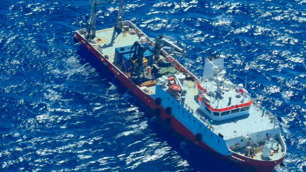
When a foreign survey ship starts loitering near your northernmost islands while broadcasting fake location data, you don't just wave hello. You look down at the seabed.
The Philippine Coast Guard recently spotted the Chinese research vessel Jia Hai Ke 7 roughly 38 nautical miles northwest of Itbayat, Batanes. It wasn't passing through. It wasn't maintaining a steady transit speed. Instead, it sat there holding position, ignoring repeated radio challenges from Philippine patrols.
Underneath those very waters run critical subsea telecommunications cables linking Southeast Asia to North America and Northeast Asia. That single fact explains why Manila is sweating.
The Trouble with the Batanes Chokepoint
Geography makes Batanes a flashpoint. Sitting between northern Luzon and Taiwan, the islands form a strategic gateway. If you control or monitor the maritime corridors here, you hold a massive window into regional communications and naval movements.
Beijing claims Taiwan as its territory, and some Chinese scholars have even pushed the fringe theory that Batanes is a natural extension of Taiwan. Manila rejects that outright. But theory aside, the practical worry centers on subsea cables.
Subsea lines carry almost all global internet traffic. They aren't buried deep in impenetrable concrete trenches all the way across; they lie exposed on the seabed or shallow continental shelves. A survey ship equipped for marine geological mapping can easily chart the exact coordinates, bury depths, and vulnerabilities of these cables.
Spotting the Ghost Signals
What made this particular incident alarming wasn't just the ship's physical presence inside the Philippine Exclusive Economic Zone. It was what the crew did with their tracking gear.
The Philippine Coast Guard used its Dark Vessel Detection system and local monitoring stations to catch the Jia Hai Ke 7 red-handed. Its Automatic Identification System trail showed a physically impossible journey—jumping from China's coast to somewhere off Papua New Guinea and back up north within hours.
That kind of location spoofing isn't a navigational glitch. It's an active attempt to hide movements from authorities. When a 2,000-tonne vessel built for geological and subsea surveys plays hide-and-seek while loitering over vital communication lines, nobody assumes it's dropping marine biology students off for a field trip.
Why Subsea Infrastructure is Modern Warfare's Soft Underbelly
People forget that global finance and digital life rely on fragile glass fibers resting on the dark ocean floor.
Governments used to worry exclusively about surface warships and fighter jets. Today, the gray-zone playbook relies heavily on research vessels, fishing fleets, and coast guard cutters. These ships operate below the threshold of open armed conflict, making them tough to counter legally under international law of the sea, which guarantees general rights of navigation and marine research in certain zones.
Yet, when a ship ignores radio queries, stays stationary over cable routes, and fakes its transponder data, it crosses the line from innocent passage to suspicious surveillance.
Manila plans to keep tracking these vessels closely. But the bigger headache isn't going away. As great-power competition heats up across the Indo-Pacific, the ocean floor has become the new front line. Guarding a few miles of open water means nothing if you can't protect the silent wires running beneath the waves.


